 Open main menu
Open main menu
Open main menu
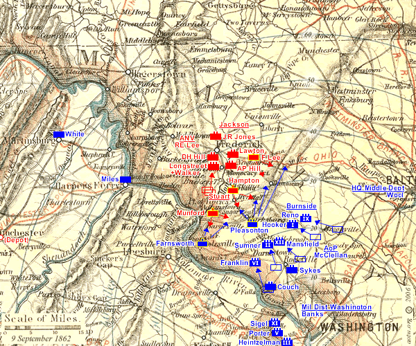
The Situation on 9 September: General McClellan pushes his Army of the Potomac further toward Lee at Frederick: his right under Burnside (I and IX Corps) to beyond Brookeville, the center under Sumner (II and XII Corps) to Middlebrooke, and his left, Franklin's VI Corps, to Darnestown. Pleasonton's Cavalry establishes a line from Poolesville at the left (south) through Clarksburg and Damascus to Ridgeville on the National Road from Baltimore, to the north and east.
General Lee's Army of Northern Virginia, screened by Stuart's Cavalry, remains in place along the Monacacy and at Frederick, but prepares to move. Lee has become concerned that the Federal garrisons at Martinsburg and Harpers Ferry, which are on his prospective supply line, have still not been evacuated as expected. He plans to split his army, sending parts of it to clear the garrisons beginning on September 10. He sends his commanders the plan in Special Orders No. 191.
)