 Open main menu
Open main menu
Open main menu
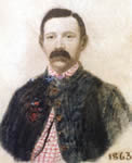
R. K. Sneden
self-portrait, 1863
(Virginia Historical Society, Richmond, Va.)
A massive and visually stunning collection of illustrations, maps, and memoirs came into the Collection of the Virginia Historical Society, Richmond in the 1990's and some pieces have recently become available to the general public through a digitization effort at the US Library of Congress. These works of Robert Sneden, late of the 40th New York Volunteer Infantry and Army mapmaker, include glorious color maps of the field at Antietam.
See more about ... the artist and the Collection in an article from the Virginia Historical Society
Robert Knox Sneden (1832-1918) was a New York artist (born in Nova Scotia) and topographical engineer. He served in the Union army, was captured, and endured prison life. The war seems to have become a virtual obsession with him, for he continued throughout his bachelor life to read, draw or copy scenes and maps, and to re-do them, along with an extensive "Diary." The results are an incredible accumulation of material that-in two increments, starting in 1994-came into the possession of the Virginia Historical Society and have thus far produced "Eye of the Storm" and a companion volume, "Image of the Storm." The Society characterizes the Sneden material as "perhaps the largest collection of soldier art to have survived." Turning the pages of those volumes and seeing the meticulous artwork and vivid colors of this contemporary artist brings an entirely new dimension to a world hitherto known mainly in black and white.
In my own research on the Confederate Army Signal Corps, I try to examine such new finds for any shreds of information, usually without success. In that connection, I recently discovered that—through arrangements with the Library of Congress and its massive American Memory project—the Virginia Historical Society had released 316 Sneden maps, available now on the Internet, compressed in JPEG form, subject to manipulation and enlargement. Paging through these I came upon a rare find indeed-Sneden had depicted "rebel signal stations" in his manuscript map "The Battle of Antietam."

Sneden Map: "The Battle of Antietam" (#194 of 316)
(US Library of Congress, from the original now at the Virginia Historical Society, Richmond, Va.)
This is but one of several maps Sneden drew of the battle field and the Maryland Campaign of 1862, but it is the only one to depict both Union and Confederate signal stations. While the Union stations closely follow those in the Atlas to the Official Records (plate XXIX, maps 1 and 2), several of the Confederate sites were new to me, raising the question of the basis on which Sneden drew his information. Was he an eye witness?
That question is speedily answered: Sneden was not at Antietam, nor was his general, Samuel P. Heintzelman, the commander for whom he may have drawn the map. Heintzelman's III Corps had been held back for the defense of Washington, and Sneden had evidently made the map to satisfy his curiosity about the battle they had both missed. It was "based on official maps held in the War Department," according to Sneden's notation, which is dated "Octr 1862." Although the plotted information concentrates on 17 September, notations refer to activities on 16 and 18 September, before and after the great battle. Since it was based upon "official maps," presumably it gives us a window into the content of maps that did not make it into the Official Records Atlas. But it may also reflect distortions of topographical and cultural data that make it difficult to transfer to a modern map on a pinpoint-accuracy basis.
To use my "rebel signal stations" as an example, and working up from the middle bottom of the map, just above the C&O canal and the Potomac, Sneden shows a "rebel signal station" [Sneden Detail 1] on a hill (shown only by hachures) due east of a house marked "Blackfords house," and just above Blackford's (Boteler's) ford, back of lines notated with the names of Generals Longstreet and A.P. Hill. This was totally new information for me.
Sneden's next location [Sneden Detail 2] for a "rebel signal station" is one that I had noted before, on a hill behind (west of) the "J. Miller" house, slightly northwest of General Lee's headquarters location. This station appears as the only "Rebel" signal station on OR Atlas map 1 of the plate previously cited, but as the site of a Union hospital in map 2.
The third station located by Sneden [Sneden Detail 3] was another one new to me: it is shown across the road from "Dr. Piper's house" on a hill overlooking the famous Sunken Road (Bloody Lane) alongside the north-south Hagerstown Turnpike, in an area frequently identified with D.H. Hill's command.
The fourth station [Sneden Detail 4] is marked "signal station," but without the word "rebel;" however, it uses the same symbol marking the other Confederate sites, and differing from the one used for Union ones. This station appears beside the Turnpike above the East Woods and the Dunker Church on a hill marked "J. Miller," behind lines held by Lawton, Ewell and Jackson.
Sneden does not show a Confederate signal and observation station on the Lutheran Church in Sharpsburg, nor one at Lee's headquarters. These were known to be in use on Septermber 17th. His depictions also do not resolve the mystery of where Stuart's signal officer, Capt. R. E. Frayser, was posted, overlooking Antietam Creek, according to Stuart's report.
Lest the reader think of the commanding towers erected later at Petersburg, or even the log "pig-pen" structure photographed by Sullivan and frequently used as an Antietam illustration, there is no reason to suspect that the Confederate signal sites at Sharpsburg were any more than convenient high ground, perhaps with any interfering saplings or bushes cut down to improve line-of-sight.
Closer study of Sneden's maps may be equally rewarding to others. For one thing, as it is on this colorful map, the "theater" of action of the Maryland Campaign must be viewed more broadly than the National Park Service boundaries and the usual battle maps. Closer study may also help to refine when he created the map - dates and times, and perhaps even suggest the sources he used.
For those readers who are more familiar with the ground, suggested locations and modern references would be most appreciated by this writer.
-- David Winfred Gaddy, Tappahannock, Virginia
AotW Member
For information about the Sneden Collection, its compiler, and a chronology of key events in his life, consult the web site of the Virginia Historical Society and search by topic. The copy of the Seden map described above is found at the American Memory site of the Library of Congress, Civil War Map Collection. It is #194 of the 316 Sneden maps posted on that site. It can be enlarged and "zoomed in/out" there for convenient study.
Also, the Musarium is hosting a very fine online presentation of excerpts from Sneden's Journal and samples of his works, with much more about his life and experiences.
The Sneden wartime self-portrait above is from his Collection, Virginia Historical Society, Richmond, Virginia.