 Open main menu
Open main menu
Open main menu
Explore the battle of Antietam and the Maryland Campaign with maps
We've prepared a number of maps to help you visualize the action on that long day of 17 September 1862, and on the days leading up to the battle. Most of them contain links to more details about the military units and soldiers they portray so you can dig deeper.
We have 15 individual battle maps based on the work of the Antietam Battlefield Board of the 1890s, giving you snapshots of the combat in short time segments throughout the day. Begin at the Battle Map page.
More than 5,800 soldiers were buried on the field after the battle. In 1864 S.G. Elliott compiled a map of those burials. I've broken that map into annotated segments and linked to the units and individuals named on it to make it easy to explore in detail.
In 1897 the Board placed 217 iron markers across the battlefield to note the positions and actions of the major army units of both sides. Follow the battle action on those markers, starting with the Tablet Map page.
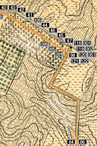
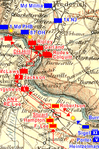
You can also look at how the armies moved in the days before the battle at Sharpsburg. We've got maps for 4 - 13 September, so far. Get oriented on the Campaign Map page.