 Open main menu
Open main menu
Open main menu
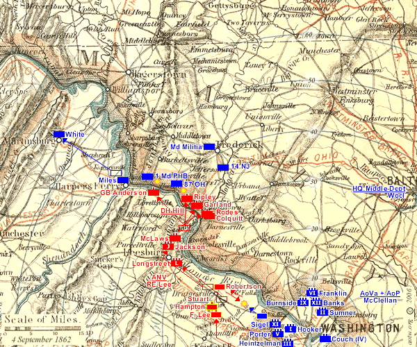
The Situation on 4 September: After it's last action at Chantilly (September 1), the defeated Federal Army of Virginia (AoV) of General Pope moved into the defences of Washington, joining General McClellan's Army of the Potomac, recently returned from the Peninsula. They are all somewhat discouraged and disorganized.
General Lee pursued the AoV as far as Dranesville, but did not have the immense strength an attack on the Washington fortifications would have required. He decided on an expedition into Maryland as the next logical step to follow his string of summer successes. He would draw the Federals out into the open, and fight them on Northern soil.
On September 4th, four brigades of his leading division under D.H. Hill cross the Potomac into Maryland: Ripley at Point of Rocks, Garland by Noland's Ferry, and Colquitt and Rodes over Cheek's Ford. While the bulk of General Stuart's Cavalry Division remain at Dranesville, elements of Robertson's Brigade (7th & 12 Va, Chew's Battery) stage diversionary attacks on the outskirts of Washington, skirmishing with Federal Cavalry near Lewinsville.
Most of the rest of the Confederate Army of Northern Virginia (ANV) move to the vicinity of Leesburg to prepare to cross the river over the following days.
)